Autopilot Kit


Autopilot Kit
The Outdoor Waypoint-based Autonomous Navigation Development KIT. he hardware and software solution that allows users to navigate by selecting GPS Waypoints which no need for prior mapping.
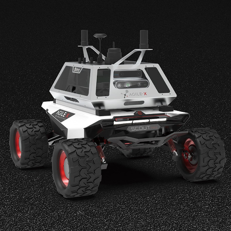
AgileX Autopilot Kit is a hardware and software solution that allows users to navigate by selecting GPS Waypoints, while also avoiding obstacles. It enables autonomous navigation and positioning, accurate route planning without the need for preloaded maps. Autopilot Kit is compatible with multiple high-performance AgileX chassis that provides out-standing off-road and climbing performance in scenarios such as agriculture, outdoor survey, construction and environmental monitoring, and perimeter security.
| Pixhawk 4 navigation i and flight control | Wireless WIFI |
| High-precision LiDAR | RTK-GPS antenna |
| High-performance Industrial Personal Computer (IPC) | Binocular camera |
| Four-wheel drive differential mobile chassis | Realsense camera |
|
A Point to point navigation |
High-precision 3D mapping |
Autonomous obstacle avoidance |
|
Four-wheel independent suspension |
CM-level RTK autonomous positioning |
Rich ROS simulation demo |
| GPS waypoint navigation without preloaded map | High-precision 3D mapping | 2D Mapping |
|
Traditional development process |
VS |
Autopilot Kit-based development |
|
Complex work for multiple sensors system fusion |
One-stop powerful software and hardware system |
|
|
Difficult to develop and valid Al algorithms |
Built-in open source ROS with rich tutorials |
|
|
low performance chassis and limited scenarios |
Multiple robot chassis options within |
|
|
Long process of components purchase |
Start core R&D application quickly |
|
|
High cost for research and development |
High cost-effective |
SPECIFICATIONS
| Vehicle body | |||
| Model | Scout Mini | LxWxH (mm) | 627x549x248 |
| Front/rear wheelbase (mm) | 450 | Vehicle weight (KG) | 20 |
| Max speed without load (km/h) | 10.8 | Min turning radius | Turnable in situ |
| Max climbing capacity | 30° | Min ground clearance (mm) | 107 |
| Front/rear wheelbase (mm) | 450 | ||
| Binocular camera | |||
| Model | Intel Realsense T265 | ||
| Chip | Movidius Myraid2 | ||
| FoV | Two fisheye lenses, combined with nearly hemispherical 163±5. | ||
| IMU | BMI055 inertial measurement unit allows precision measurement of rotation and acceleration of equipment | ||
| Depth camera | |||
| Model | Intel Realsense D435i | ||
| Depth technology | Active IR Stereo | ||
| Depth stream output resolution | Up to 1280*720 | ||
| Depth stream output frame | Up to 90fps | ||
| Min depth distance | 0.1m | ||
| Laser radar | |||
| Model | Rplidar S1 | ||
| Laser ranging technology | TOF | ||
| Measuring radius | <40m | ||
| Sampling speed | 9200 times/s | ||
| Measuring resolution | >1cm | ||
| Scanning frequency | 10Hz (8Hz-15Hz adjustable) | ||
| RTK-GPS module | |||
| Satellite signal Supported Types | GPS / BDS / GLONASS / QZSS | ||
| RTK positioning accuracy | horizontal 10mm +1ppm vertical 15mm +1ppm |
||
| Orientation accuracy (RMS) | 0.2° / 1m baseline | ||
| Speed accuracy (RMS) | 0.03m/s | ||
| Time accuracy (RMS) | 20ns | ||
| Differential data | RTCM2.x/3.x CMR CMR+ | ||
| Data Format | NMEA-0183, BINEX Femtomes ASCII and Binary format |
||
| Data Update | 1Hz / 5Hz / 10Hz / 20Hz (optional) | ||
| Pixhawk 4 Autopilot | |||
| FMU processor | STM32 F765 | ||
| IO processor | STM32 F100 | ||
| Accel/Gyroscope | ICM-20699 | ||
| ACMEL/Gyroscope | BMI055 | ||
| Magnetometer | IST8310 | ||
| Barometer | MS5611 | ||
| Servo Guideway Input | 0-36V | ||
| weight | 158g | ||
| Size | 44x84x12mm | ||
| GPS | ublox Neo-M8N GPS/GLONASS receiver; integrated Magnetometer IST8310 | ||
| Onboard Computer | |||
| Model | X86 | ||
| CPU | I7-8th Generation | ||
| Memory | 8G | ||
| Storage | 128G solid state | ||
| System | Ubuntu 18.04 | ||
| ROS | melodic | ||
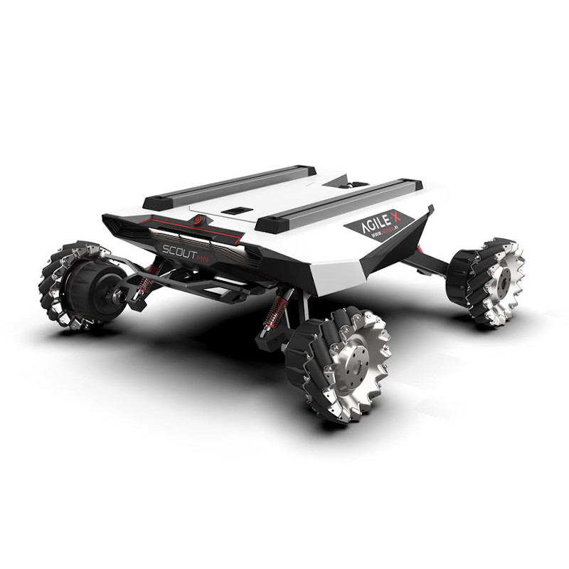
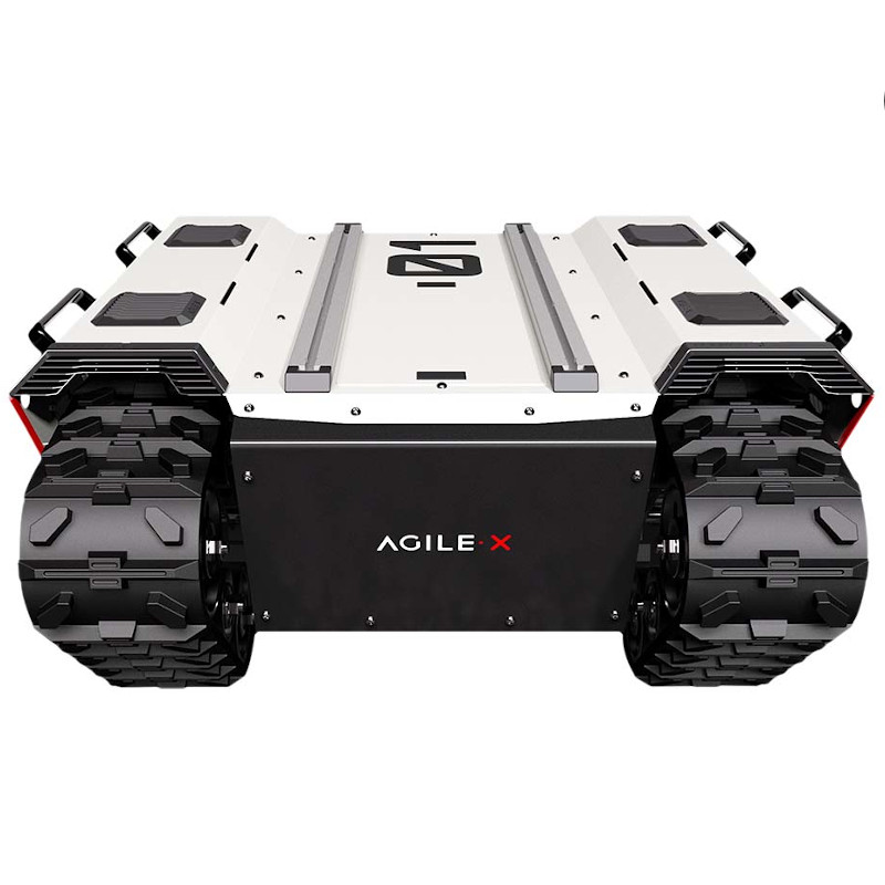
Chassis options
 |
 |
 |
|
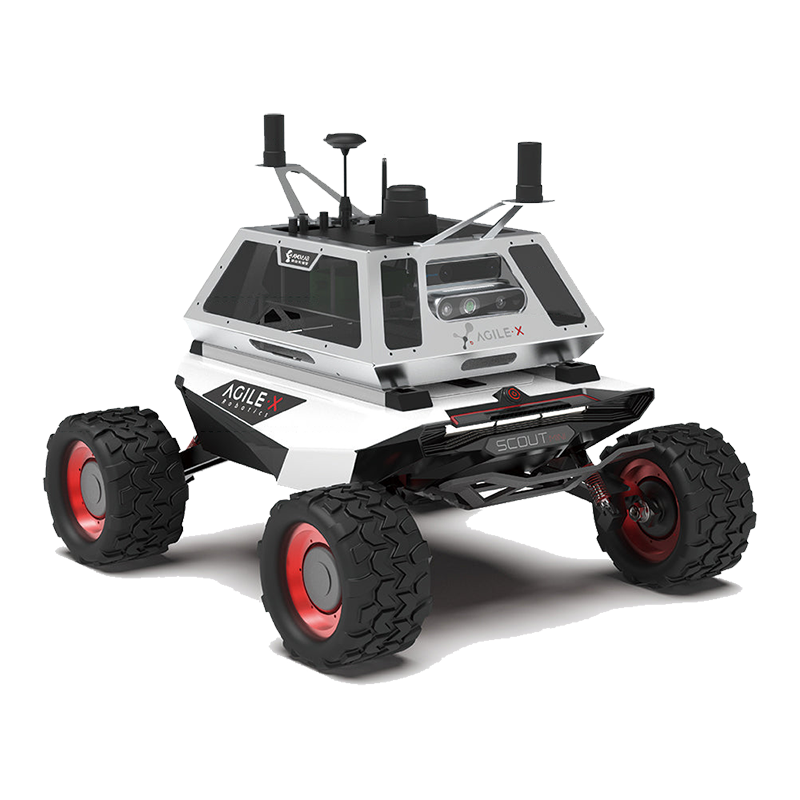
Scout Mini off-road version |
Bunker |
Scout2.0 |


")
")
")